winter keeps on keeping on: major snow tonight for chicago
Even though meteorological winter ends in 21 days here in Chicago, mother nature and her angry friend old man winter are about to put on a show for us.
Riding along a very strong jet streak separating anomalously cold air to the north and anomalously warm air to the south and west is a pocket of moisture and vorticity that is currently dropping southeast out of Alberta/British Columbia. We usually call these systems "Alberta Clippers" and they usually drop meager amounts of snow, but the combination of a strong jet stream and sharp temperature contrast will cause the clipper to slow as it approaches the Midwest and allow it to pick up some needed moisture as it converges on the Chicago area.
Here's a map showing the temperature contrast (at 850mb) around midnight tonight:

And the associated strong jet streak (the 250mb winds) also at midnight tonight:

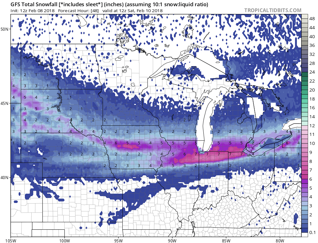
The combination of these strong forcing events will induce cyclogenesis and produce a strip of heavy snowfall stretching from Erie, PA northwest toward Montana with a peak in snowfall intensity centered on Chicago around daybreak Friday:

The result could be, 6-12" of snow by the end of the day on Friday, as depicted by the 3 major weather models (NAM, GFS and ICON), though significant variability continues to exist in regards to where the main band of heavy snow sets up:

Temperatures will gradually rise throughout the night as the baroclinically unstable atmosphere, and associated low pressure, draws warmer air northward but as the storm passes, temperatures will crash.
The 6-12" of snow will add to the 6.0" of snow we've received already this week (at O'Hare) and will probably catch us up (and then pass) the "average snowfall" so far for the year (the average is 13.4", and we've received 10.6" so far, as of February 8):

The cold temperatures we've been experiencing since Saturday (the last time the thermometer was above freezing was early Sunday morning) will continue through the weekend, with a sharp drop in overnight lows occurring Sunday night into Monday morning (with widespread negative readings Monday morning):